Visualizing Geospatial Data in Imply Pivot
Previously, I looked at spatial dimensions in Apache Druid. Since Imply created Pivot as a tailored visualization tool for Druid data, I would like to take advantage of the built-in map view to show my spatial dimensions on a map. How will we go about this?
Pivot cannot display latitude/longitude coordinates directly on a map but it can interpret geocoded data in Geohash format. If we could transform our coordinates into a geohash, sure we would be able to make the map visualization work!
Until recently, this was only possible with a hack using Javascript. But with Imply’s extensions to Druid, it becomes a breeze! The functionality was added in Imply version 2022.02, so be sure to use the latest version if you run the test.
Setting Things Up
You can use the trial version of Imply for this tutorial. To get started, register and follow the instructions to download and install the software.
The imply-utility-belt extension has to be enabled in your common properties. If you are using the quickstart on unmanaged Imply Enterprise, look into the file conf-quickstart/druid/_common/common.runtime.properties and make sure it is included in the extension list:
#
# Extensions
#

druid.extensions.directory=dist/druid/extensions
druid.extensions.hadoopDependenciesDir=dist/druid/hadoop-dependencies
druid.extensions.loadList=["druid-histogram", "druid-datasketches", "druid-kafka-indexing-service", "imply-utility-belt"]
For the Cloud version of Imply Enterprise, this is configured in the Manager UI.
Generating Data
I am using a simple Python script to generate my sample data. (You will need the Faker module.)
import json
from faker import Faker

fake = Faker()

def main():

    print("datetime,latitude,longitude,place_name,country_code,timezone,measure")

    for i in range(0, 10000):
        datetime = fake.date_time_this_month().strftime("%Y-%m-%d %H:%M:%S")
        place = fake.location_on_land()
        measure = str(fake.random_int(min=1, max=100))
        print(f"{datetime},{','.join(place)},{measure}")


if __name__ == "__main__":
    main()
The result looks like this:
datetime,latitude,longitude,place_name,country_code,timezone,measure
2022-02-09 13:37:51,14.37395,100.48528,Bang Ban,TH,Asia/Bangkok,13
2022-02-05 03:13:14,35.61452,-88.81395,Jackson,US,America/Chicago,8
2022-02-02 04:04:50,-19.65,47.31667,Antanifotsy,MG,Indian/Antananarivo,56
2022-02-01 17:11:39,49.13645,8.91229,Eppingen,DE,Europe/Berlin,60
2022-02-07 00:40:52,8.43333,99.96667,Nakhon Si Thammarat,TH,Asia/Bangkok,11
2022-02-03 13:33:20,35.74788,-95.36969,Muskogee,US,America/Chicago,76
2022-02-17 20:59:38,12.74482,4.52514,Argungu,NG,Africa/Lagos,17
2022-02-09 20:25:55,51.44889,5.51978,Tongelre,NL,Europe/Amsterdam,72
2022-02-08 12:04:56,6.84019,79.87116,Dehiwala-Mount Lavinia,LK,Asia/Colombo,27
Ingest these data without any changes or transformations, using monthly segments.
Loading the Data into Pivot
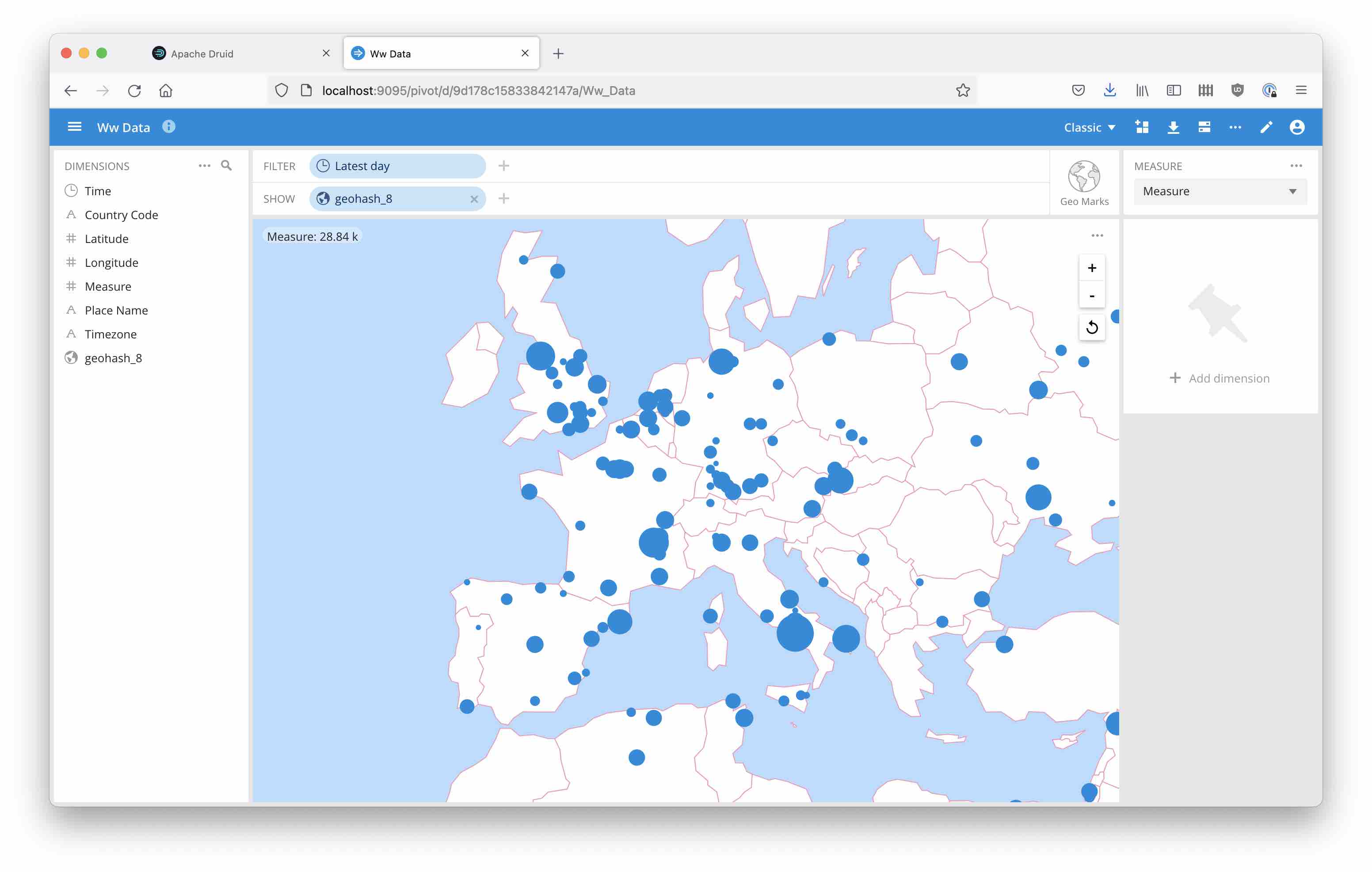
Let’s first generate the Geohash dimension in Pivot on the fly.
Create a SQL cube from your data in Pivot.
In order to visualize the data on a map, use the new ST_GEOHASH function which is supplied by imply_utility_belt. It takes three parameters:
- longitude
- latitude
- an integer between 1 and 12 describing the precision, that is the length of the Geohash string.
Make sure to tell Pivot that this is a Geo dimension:

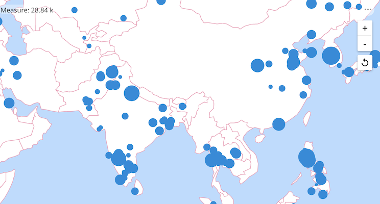
Then you can use the new dimension to show your data in a map view.
Precomputing Geohash during Ingestion
If you have a larger data set, you may want to precompute the geohash column. This is possible using the st_geohash function in a native expression:
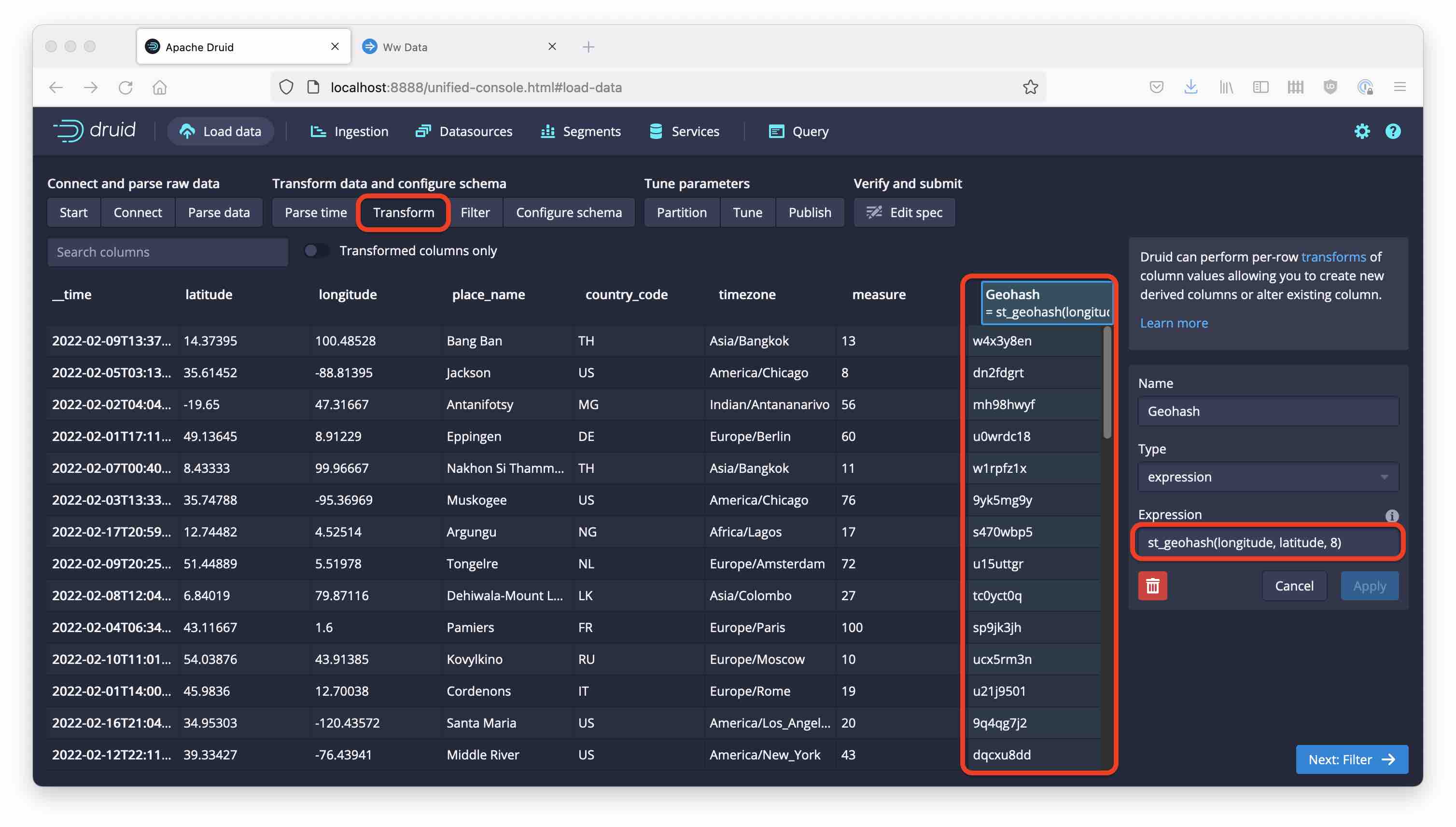
This is faster at query time but might be considered less flexible. However, you could precompute geohash with a high precision and then just truncate the string if you need shorter geohashes.
Learnings
- In order to use Imply’s own visualization tool, there is now a function that creates Geohash strings out of geographical coordinates.
- This is new in Imply 2022.02 and is available both in SQL and Druid native query.
- It is found in the
imply-utility-beltextension.